

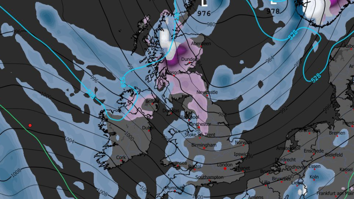

Millions of people in the UK may experience snowfall on Christmas Day based on the latest weather maps, indicating a potential White Christmas. The GFS weather model projects heavy snow showers in Northern Ireland and Scotland on Christmas Eve, with chances of light snow in northern parts of England.
Snow is forecasted to persist on Christmas morning, with western Scotland expected to see the most intense snowfall by 3 am. Southern Scotland, the Lake District, and the Pennines in England could also witness heavy snow during this time.
By 6 am, the maps show that the heaviest snow is likely to fall around Galloway Forest Park in Scotland, with cities like Glasgow and Dundee possibly experiencing snowfall. In England, Manchester might encounter light flurries according to the projections.
Snow coverage maps for 6 pm on Christmas Day suggest that significant areas of northern England, Northern Ireland, and Scotland may have snow covering the ground. Cities such as Manchester, Edinburgh, Glasgow, and Dundee appear poised for a traditional White Christmas.
To officially declare a White Christmas, the Met Office specifies that just one snowflake needs to fall on December 25. The likelihood of widespread snowfall is deemed “very low” by the national weather agency, with any snow in late December expected to mainly occur in higher elevated areas.
The Met Office’s forecast from December 25 to January 8 indicates a potential shift towards drier and settled weather patterns, with higher chances of frost and fog. While spells of rain and strong winds remain possible, the likelihood of widespread snow and ice is anticipated to remain minimal.